Key Highlights
- The Himalayan region is seeing more GLOF risk. This is mostly because climate change is making glaciers melt faster. Glacial lakes are getting bigger and not as safe as before.
- Earthquakes are important in this area. They can make slopes weak, shake up natural dams, and cause other events to happen too.
- Glacial lake outburst floods can damage roads, bridges, hydropower projects, and homes in mountain areas. All this can happen in just a few hours.
- For better disaster management, it is key to map hazards. People need to check glacial lakes and use early warning systems.
- India is trying to lower these risks. The country is using NDMA guidelines, getting communities ready, and following glacial lake monitoring with science.
- Regional cooperation is needed as many glacial lake outburst floods and other problems in the Himalayan region cross borders through shared rivers.
Table of Contents
Introduction
The Himalayan region is one of the world’s most fragile mountain areas. This means disaster risk is always a big issue for the people who live here. Glacial lakes keep getting bigger. Slopes are weak. Also, more and more people now live in narrow valleys. Because of this, there can be more sudden floods and landslides.
If you want to know why disasters in the Himalayan region get so bad so fast, you need to look at the mountains and the things that affect them. A lot starts with the rocks in the area and how open it is to danger.
The Himalayan Region: An Overview of Geology and Vulnerability
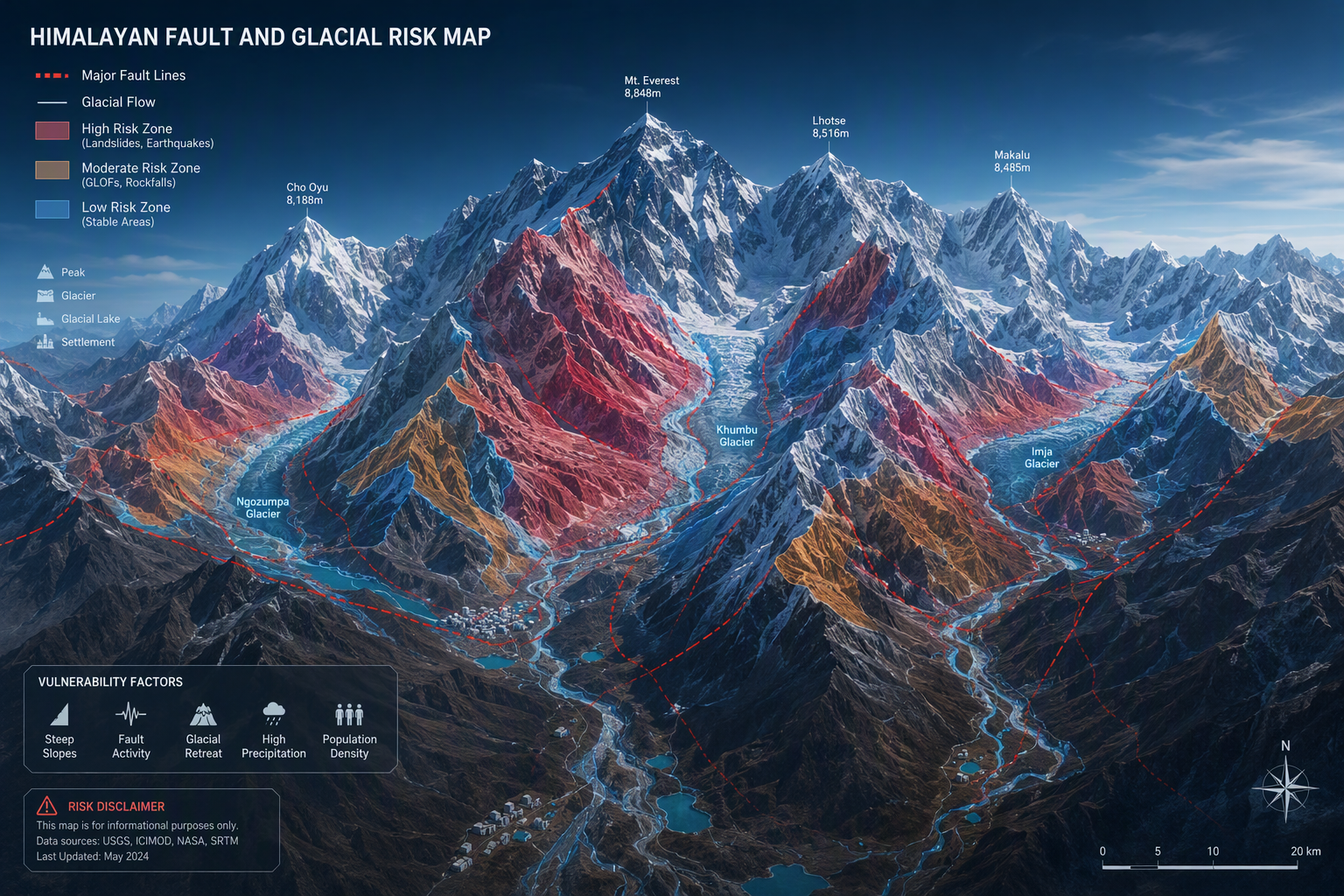
The Hindu Kush Himalaya is young and always changing. It is not very steady. There are steep slopes and many loose rocks here. The glaciers also change a lot. All these things help glacial lakes form behind natural dams. These dams are made of loose moraine or ice. In the Hindu Kush region, you will often find glacial lakes and natural dams.
People, roads, and hydropower projects are in the valleys at the base of these hills. These places can be in danger. That is why hazard assessment and disaster preparedness are important here. To know why this area is at high risk for landslides or glacial lake outburst floods like GLOFs, we need to look at its land, where people stay, and the bigger worry for India.
Unique Geological Features of the Himalayas
The Himalayas were made when the plates under the ground moved and hit each other. This is still happening today. Because of this, the Himalayas have young rocks that can bend. A lot of the rocks here are broken. The ground is not strong, and you feel a lot of shaking in the earth. The land is weak, so landslides can happen a lot. Sometimes, they happen without any big reason.
Then next, the glacier starts to change. There is fast warming in the Hindu Kush Himalaya. This leads to glacial retreat and glacial lake formation happening faster. The meltwater gathers in low areas left when the ice moves back. Usually, moraine dams hold this water in. But these moraine dams are not very strong. They can be moved or broken by rain, avalanches, or earthquakes.
The Himalayan region has a high risk of glacial lakes breaking and landslides. A glacial lake that is not stable can be a big danger to all the areas that are downstream. Today, remote sensing and satellite monitoring are very important. A lot of these glacial lakes are in high places, and it is hard for people to get there. People cannot go there easily to see these glacial lakes in the Himalayan region, so remote sensing and satellite monitoring help us watch them.
Population Density and Human Settlements in Mountainous Terrain
Life in the Himalayas is tied to mountain valleys. People build their villages and towns in these places. You can see roads, bridges, farms, and hydropower projects here as well. The problem is that many of these places are prone areas. They often sit under unstable slopes and glacial lakes that keep getting bigger.
People who live in local communities face disaster risk every day. Landslides block roads. Sometimes, they take away homes or cut off whole villages. GLOFs come fast, and there is not much time for people to get out. Flood waters can wash away bridges, make drinking water bad, and cover fields with rocks and dirt.
This is the reason people face more risk when they live in the mountains. The roads, power lines, and other things people build often run down the river paths. Fast floods will use these same ways. If something goes wrong, travel, power, tourism, and jobs can all get hurt at the same time. In these places, even one small problem can turn into a big crisis fast.
Why Understanding Himalayan Disasters is Crucial for India
For India, the Indian Himalayan region is not just a place with high mountains far away. This himalayan region has main roads, big rivers, power plants, and many people living in places that can be risky. When any disaster happens here, it can damage roads, stop power, make water unsafe, and affect the local economy.
That is why disaster management now means getting ready before anything bad happens. It is not only about giving help after a problem. India is spending more time on hazard assessment. The country checks dangerous lakes, and it looks at the places where landslides can happen. Risk reduction is also a big part of what they do in disaster management. They use structural measures if they need to as part of their plan.
Key priorities include:
- using science to find lakes and slopes that are not safe,
- helping people get ready by giving them training, practice drills, and plans they can use in the community,
- making systems work better so they can watch the area, send warnings, and keep people safe in open valleys.
Learning about these disasters helps us see why earthquakes matter so much in the Himalayas.
What are Earthquakes and Their Relevance to the Himalayas
Earthquakes take place when there is a sudden release of energy inside the Earth’s crust. In the Himalayas, this is something that happens often during the day because the mountains keep changing. The Indian subcontinent moves into the Eurasian plate. This is why you can see a lot of seismic activity in the mountain area.
Why does this matter for disaster risk? Shaking can make slopes weaker. It can break walls of rock and dirt built by glaciers. It can also change how glacial meltwater moves. In the Himalayas, when there is an earthquake, it is not just by itself. It often leads to more danger. The next parts will talk about these other risks in more detail.
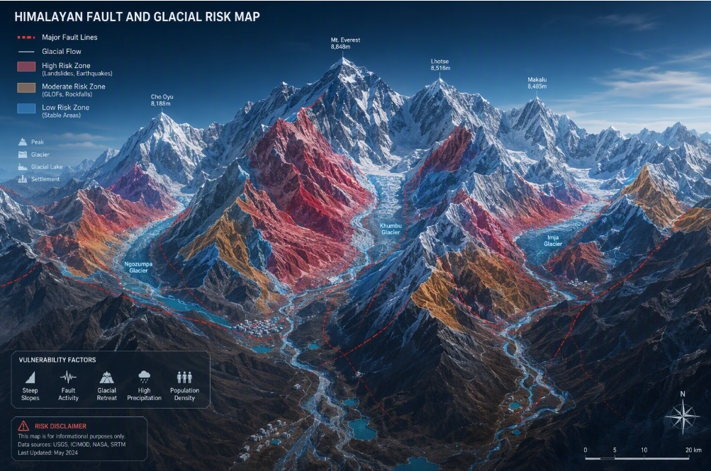
Plate Tectonics and Seismic Activity in the Indian Subcontinent
The Himalayas are there because the moving plates under the ground push together. The Indian Plate moves up to the north. It keeps bumping into the Eurasian Plate. This pressure builds up along big cracks in the area. The push from this makes the region very likely to have earthquakes. The Himalayas are known as one of the most active spots for earthquakes in the Indian subcontinent.
Seismic activity matters a lot because when the ground shakes, it can make weak mountain slopes even weaker. The shaking can cause rocks to break up. Dirt and stones that are already loose may start to move. This makes it easier for landslides to happen. In valleys with glaciers, earthquakes can do even more. They can make the sides of the slopes fall. They can also block rivers, which can bring sudden floods to people and places downstream.
There is another link too. As glacial retreat keeps going, there are more lakes that form behind weak natural dams. This makes the danger bigger for people and places nearby. If an earthquake shakes these ice walls or moraine dams, lake water can rush out very fast. So, seismic activity does not just cause earthquakes. It can also make the risk of landslides, flash floods, and events like GLOFs go up.
Historical Earthquakes in the Himalayan Belt
The Himalayan belt has had many earthquakes that bring a lot of damage. When a big one hits, it shows the mountains can break in several places at the same time, not just in one spot. For disaster management, it is key to study how the ground shakes during these events. We should also look at problems like landslides and rivers that get blocked.
Today, people use field investigations and remote sensing to check what has changed after an earthquake. These tools help to find things like risky slope movement or damming. These things can happen far from cities and roads, so the tools are very useful.
| Aspect | Relevance in the Himalayan belt |
|---|---|
| Earthquake occurrence | Common because of active plate collision and built-up crustal stress |
| Immediate hazard | Ground shaking damages settlements and destabilizes slopes |
| Secondary effects | Landslides, river blockage, debris flows, and sudden flooding |
| Why it matters | It shapes disaster management planning in mountain states |
| How it is studied | Through field investigations and remote sensing in difficult terrain |
For the UPSC, it is good to talk about recent flood events like Kedarnath, Chamoli, and Sikkim. These are the places that had big floods. These examples help us see how mountain problems and dangers often come up together.
How Earthquakes Trigger Other Natural Hazards
An earthquake in the Himalayas does not stop when the ground stops moving. In steep areas, it can trigger landslides. These landslides can cover a lot of ground and sometimes block rivers. This can make new lakes for a short time. These lakes can give way and run out fast, sometimes without warning.
This can also affect glacial systems. If the moraine barrier is not strong, an earthquake can break it or cause loose rocks to slide. The chance for outburst floods gets higher. There is even more risk for lake outburst floods if the water volume is high from glacier retreat and rain.
Common cascading effects include:
- Earthquakes can shake the ground and make landslides. These landslides can block narrow valleys.
- A river that gets blocked can break through later. This can lead to flash floods.
- A glacial lake that is not stable can break apart. This can lead to outburst floods downstream.
This link between shaking and problems that come one after the other shows us why landslides and GLOFs happen. These things are very important for UPSC ideas.
Landslides and GLOFs UPSC: Core Concepts and Definitions
Knowing about landslides and glacial lake outburst floods (GLOFs) is important for the UPSC exam. A landslide is when loose soil and rocks move down a hill because of gravity. This can happen after heavy rainfall or glacial meltwater comes down from above. A glacial lake outburst flood is when glacial lakes lose a lot of water quickly. This takes place if an ice dam breaks or if a lot of rain falls into the glacial lakes and causes them to overflow. The floods that follow may lead to catastrophic flooding.
Both glacial lake outburst floods and landslides are a big problem in the Himalayan region. They put people at risk and make disaster management more difficult. That is why it is key to know about glacial lakes, what can trigger lake outburst floods, and how glacial meltwater or heavy rainfall can bring an emergency. A good hazard assessment and a strong emergency response can help handle these risks and keep people safe.
What are Landslides and Glacial Lake Outburst Floods (GLOFs)?
Landslides happen when rock and soil move quickly down a slope. Heavy rain or earthquakes can bring on these slides. Glacial lake outburst floods, also called GLOFs, occur when glacial lakes break open and send a lot of water out fast. This water can be very dangerous. It may cause great damage for people living down from the lake. Glacial lake outburst floods and landslides are both big dangers in mountain places. They happen in places where there are glacial lakes and can lead to outburst floods or lake outburst floods.
Differences Between GLOFs, Landslides, and Regular Floods
At first, these disasters can look the same. They all bring damage. There is a lot of water, and things get broken or taken by the water. But each happens for different reasons. A landslide is when dirt or rocks on a hill go down. A usual flood is when rain falls for a long time. Rivers then fill up too much.
How they move is not the same, too.
Lake outburst floods can come fast. They happen when the dam of a glacial lake breaks. A huge water volume quickly rushes out. This is why lake outburst floods often feel and look like flash floods, especially in steep mountain places.
Here is the key difference:
- GLOFs start when something breaks through the glacial lake barrier.
- A regular flood often happens after lots of rain, when water comes down slopes, or when a river goes over its edge.
- A landslide is when earth and rocks move down, and it is not caused by flood waters.
- A landslide can trigger landslides in other places, block rivers, or make floods worse.
For UPSC, it is good to know the differences. This can help you write better answers. You will not get things mixed up that are close but not the same.
Importance of Landslides and GLOFs for UPSC Preparation
Knowing about landslides and glacial lake outburst floods is important for UPSC preparation. These events can tell us how climate change, outburst floods, and human actions can come together and cause problems. If you want to be a civil servant, you should know how glacial meltwater works, what glacial lake outburst floods are, and how these floods can be risky. This knowledge will help you create good disaster management plans and support people in the Himalayan region when such events happen.
When you know about glacial lake outburst floods and landslides, you will also see what makes the Indian Himalayan region more at risk in some places and not so much in others. This topic is important for the UPSC syllabus and helps people who want to work in this region. Learning about all these things will not just help you do better in the exam, it will also help keep people safe when things get hard.
Causes of Landslides and GLOFs in the Himalayan Region
The causes of landslides and GLOFs in the Himalayas do not come from just one reason. Most of the time, several things come together to make them happen. The land in that area is weak. The glacial meltwater keeps growing. Heavy rainfall or earthquakes can also start these events. When all this happens at the same time, it can lead to landslides and GLOFs.
Glacier retreat is causing more lakes to form as time goes on. At the same time, extreme weather and changes to the slopes make the area less safe. This is why glacial lake monitoring matters so much. To know what is really happening, you have to look at things like how the ground is, the stress from climate, earthquakes, and how people use these mountain spots.
Geological and Geomorphological Factors
Start by thinking about the mountains. The Himalayas are still getting bigger and rise up fast. A lot of rocks in the area crack and fold. This causes many slopes here to not be steady. There is also soft soil, rocks that come from old glaciers, and narrow valleys. When you add all of these things together, it makes it easy for the ground to break and slide down.
Glacial retreat can cause more risk. When glaciers get smaller, they leave behind low areas. Water from melting ice fills these spots, which can then turn into new lakes. A lot of these lakes have natural dams holding the water in. These natural dams are called moraine dams. Moraine dams are not strong. They are made of loose rock, sand, dirt, and ice under the ground.
This is why it is so important to look at the land and shape of the ground for hazard assessment. A place may already be at risk even before anything triggers it. Remote sensing can help find growing lakes, loose ground, and new water paths in areas where people cannot reach easily. In the Himalayas, the land is one big reason there is danger.
Climatic Stressors and Extreme Rainfall
Climate change is making life harder in the Himalayan region. As it gets hotter, the glaciers start to melt faster. This means there is more glacial meltwater moving through the mountains. When the lakes get larger from all this meltwater, there is more pressure put on their natural walls, known as moraines.
Heavy rainfall and intense rainfall can make problems worse. A cloudburst or a quick burst of very heavy rain can make the lake fill up fast. It can also make the ground on slopes very wet and wash away parts of a dam. In a steep valley, this can lead to flash floods and cause the slopes to break apart.
Warming has many effects on glacial lakes. It causes more glacial lakes to form and makes them bigger. As the weather gets warmer, the land around glacial lakes gets weaker. This type of climate change makes avalanches, slope falls, and sudden floods into glacial lakes happen more often. In short, when things get hotter and there is more rain or not enough, problems in the mountains become more common.
The Role of Seismic Activity and Earthquakes
Earthquakes are a big cause of danger in the Himalayas. The whole mountain range is in a place where the plates of the earth move and press against each other. When the ground shakes, rocks can get loose. Old landslides can also start moving again. In just a few minutes, these shakes can upset valley systems in the area.
That makes disaster risk go up in two ways. The first way is that earthquakes can start a lot of landslides. A lot of these landslides block rivers or break roads. The second way is that the shaking can make moraine or ice walls weaker. These walls hold glacial lakes. When this happens, glacial lakes can break with no warning.
So yes, when the ground shakes, landslides and glacial lake outburst floods, or GLOFs, can happen more often. In the Himalayas, an earthquake can start a problem. But it is not the only thing that happens. After an earthquake, there can also be floods or landslides. The three dangers often come close together. That is why, when we make plans, we have to think about all of them—earthquakes, flooding, and slopes that are not solid. It is not good enough to look at just one risk on its own.
Human Activities and Infrastructure Development
People have put more and more pressure on many valleys in the Himalayas. A lot of the road work there does not follow science or best practice. People dump waste and dig up big parts of the land. There are tunnels and buildings that are not planned well. All these things make the already weak land even more risky. When people change how the land is used, they often do not think about how the ground in the mountains is not steady.
Building things like hydropower projects, roads, and mountain routes can put the area at more risk. These things are often built near rivers. Rivers can have floods and debris flows a lot. If a big event happens, hydropower projects and other things could break. This can make damage downstream even worse.
Major concerns include:
- Road widening and digging work go into steep hills. These hills are not stable, so there can be problems.
- Hydropower projects and tunnels happen in weak river valleys. These areas are not very strong.
- More people are moving in to these places now, and more tourists come too. These spots can be dangerous.
These things make people feel the impact in the Himalayan areas.
Impact of Earthquakes, Landslides, and GLOFs on Himalayan Communities
In the Himalayas, disasters do more than move the land around. They hurt homes, farms, roads, and schools. They can change how people live and earn money in the mountain valleys. A lot of these places are far and hard to get to. So, if there is any break in life, even for a short time, it can turn into a big problem for people.
Local communities are often the first to help when something goes wrong. They usually start to work before other teams come in. This is why disaster preparedness and emergency response are so important. To understand how big the problem is, you have to look at social losses, damage to roads or buildings, and changes to the environment together. Do not look at these problems one at a time.
Socio-Economic Effects on Local Populations
For local communities, glacial lake outburst floods can lead to loss of life and force people to leave their homes. These outburst floods from glacial lakes happen very fast. People who live downstream often do not get enough warning before the water comes. Families may lose their houses, animals, crops, or even clean water in just one night because of glacial lake outburst floods.
The effects on the local economy stay for a long time. Roads get blocked, and the number of tourists goes down. Markets close, and rice fields or farms can get covered in dirt and stones. In places that are far from cities, people may not earn money for weeks or months. It’s not just for a few days.
Emergency response can be harder when it takes place in mountain areas. Relief camps, rescue workers, and things like food or tools can need more time to get to places that are hit. This problem can make disaster risk higher for people who live far from others. Most times, it is the people who live there that first look for others, help anyone hurt, or get them out before any outside help comes.
Impact on Critical Infrastructure and Mountain Transport
When roads and bridges get damaged, it can make a natural hazard feel even worse for people living in the area. In Himalayan valleys, you will find that the roads, bridges, tunnels, and hydropower systems are close to rivers and are sometimes built in places that are not steady. So, these are at high risk when there are landslides, debris, or strong flood waters.
When mountain transport does not work, people can’t move fast. Rescue teams take more time to get there. Supplies do not come on time. Whole places feel cut off.
If you are working to build roads or bridges in the mountains, you need to think about slope safety, how rivers move, and sudden flood water. It is not only about doing the job fast or making it easy.
Common impacts include:
- Sudden flood can wash away bridges and roads.
- Hydropower plants and communication systems may get damaged or lost.
- There can be long disruption. This shows a need for stronger structural measures and safer planning.
This shows that keeping things safe is not only about fixing what is broken. It is also about checking where things are made and how they get built.
Environmental and Ecological Consequences
These disasters can change the environment in big ways. A landslide can take away all the trees and plants from a hill. A flood can move rocks, mud, and other things down into a valley. A river can get wider, move to a new spot, or fill up with things that come along with the water. This can make the whole area around the river look and feel different for everyone.
Water bodies also feel the impact when there is glacier retreat. When floods bring in a lot of dirt, the quality of water gets worse. This affects life in the water and the system close to it. As glacial meltwater from glacier retreat finds new ways to flow, it makes river basins less stable for a long time.
The things that happen to nature can be more than what you first see. Trees be pulled out of the ground. Homes where animals live can get broken. Water in rivers can also change because of it. This is why field investigations after a big event are helpful. They let us see what gets lost, like roads. But they also help us notice changes in the land that can make it risky for the people living there in the future.
Recent Examples of Glacial Lake Outburst Floods and Landslides in India
If you want to see examples, you can look at Chamoli, Kedarnath, and Sikkim. These places have had glacial lake outburst floods, lake outburst floods, and other mountain risks. In these areas, rainfall, slope failure, and open buildings also bring trouble.
They also show why remote sensing has become so important in the Himalayas. What happened at South Lhonak lake, the Kedarnath area, and Chamoli are the main things people look into. These places help us understand new hazard patterns in the Himalayas. If you want to know the latest about the area, you should know about remote sensing studies and these major events. UPSC aspirants can get a good idea of what is going on there if they read about this.
Notable GLOF Events: Chamoli, Kedarnath, and Sikkim
Several disasters in India lately show how risky the Himalayas can be. Each disaster had fast water, a lot of debris, and strong effects for people who live down the river. The reason for each event is not the same, but all of them add to the risk. These problems show why glacial lake outburst floods, lake outburst floods, and outburst floods are still a big worry for India.
For UPSC, these are the most important examples:
- Chamoli, 2021: There was ice and rock that fell down along with GLOF-like happening in the Nanda Devi area. Because of this, heavy damage was done to hydropower projects.
- Kedarnath, 2013: A sudden outburst at Chorabari Lake and heavy rainfall came at the same time. This caused a sudden flood and great loss for people living there.
- Sikkim, 2023: There was heavy rainfall and a cloudburst. After that, the South Lhonak lake in the Teesta basin burst, which brought a lot of damage.
In each case, the lake water, things like debris, and the way the valley was shaped made the damage worse. All of these things worked together to cause more harm. These events show us that different things can happen, but they may lead to the same type of disaster down the line.
Landslide Incidents Linked to Seismic Events
Not every disaster in the Himalayas begins with rain. A strong earthquake can also trigger landslides in big areas. This can happen a lot when the slopes are already cracked. Most of the time, these landslides do not show up in the news, but they do add to the disaster risk in the mountains.
The real danger comes from things happening one after the other. When a slope falls, it can block a river. This can hold water and make a lake for a short time. If the blockage breaks, it can cause a sudden flood. So, a ground shake can lead to problems that might show up later. A sudden flood can happen hours or even days after the first event.
Remote sensing is very helpful in this case. It can find new scars on slopes, show if rivers are blocked, and spot any change in land, even if we can’t go to those places. If you are getting ready for UPSC, you have to know that earthquakes can do more than just shake the ground. They also trigger landslides, and these cause more trouble over big areas.
Lessons Learned from Recent Himalayan Disasters
Recent disasters in the Himalayas show that it is not enough to act only after something happens. If we wait until a disaster hits, it will put lives, homes, and jobs at risk. So, disaster management should start with science. We need to find which areas are risky before something goes wrong.
Another lesson is that it is important for the warning to get to people fast. The data from watching the event works well, but only if it helps people leave safely, get help, and feel trust with the public. Because of this, talking with local people, practice drills, and planning the way to leave are just as important as new technology.
The clearest lessons are:
- Early warning systems need to be tied to real community preparedness. They should not just be another piece of equipment.
- Hazard assessment should guide the planning of roads, dams, and homes in areas that could be at risk.
These lessons get us to the question. We need to talk about what steps people can take to make things better. These steps are called mitigation strategies.
Strategies for Mitigating Risks of Earthquakes, Landslides, and GLOFs
India now puts prevention at the top of its mitigation strategy. In the past, there was more focus on relief after disasters happened. Now, India uses NDMA guidelines and does hazard assessment. The country also works on glacial lake monitoring. There are better systems in place to find dangerous lakes and rough slopes before any big trouble starts.
There is work happening to put early warning systems and structural measures in places where there are often problems. But technology alone is not enough. For early warning and protection plans to work, there must be good groups in charge. People need strong local skills. It is also key to have clear steps to follow.
The next parts will talk about how early warning, watching what is happening, rules, and teamwork with the community all go together.
Monitoring, Early Warning Systems, and Technology
Monitoring glacial lakes is the first thing you need to do for safety in the Himalayas. A lot of glacial lakes are far away, hard to get to, and they are not always active all the time. That is why people now use satellite imagery, remote sensing, and automated tools for glacial lake monitoring.
India now makes it easier to see and track changes by using many groups. There are weather stations, and there are sensors on lakes, too. Some tools watch water flow and can send updates fast. All of these help with emergency response. Remote cameras and radar tools work well, mainly during the monsoon. At that time, it is often hard to go to some places by road.
Important tools include:
- Satellite imagery helps us see how lakes get bigger and how the slopes around them change.
- Sensor-based early warning systems help us watch lake levels and river discharge.
- Automated weather and water stations send real-time alerts.
These systems are getting better. But they help people the most when there is a clear local plan to get people out safely.
National Policies, NDMA Guidelines, and Community Involvement
Policy support is now stronger than before. The National Disaster Management Authority has set out clear steps for disaster management. The NDMA rules talk about finding lakes, marking danger areas, checking on lakes, managing drainage, telling people early, and making plans to get people out safely. This shows that they want to stop problems before they happen and cut down on risks.
India has begun a national GLOF risk mitigation programme. The country wants to make sure that all groups, like CWC, ISRO, IMD, GSI, and others, work well together on this. Now, when new dams are made in glacial areas, they need a GLOF risk safety study. They must also have good plans to handle GLOF risk.
Community involvement is very important. People who live in the area often help first when something happens. Key efforts include:
- training local volunteers in warning, evacuation, and first aid,
- promoting disaster preparedness through drills and awareness campaigns,
- combining official systems with community preparedness for faster response.
This national way is needed even more when dangers move from one country to another.
International and Transboundary Approaches to Himalayan Hazard Management
Himalayan hazards do not stop when they hit a country border. Rivers, glaciers, and dangerous lakes can start in one country and flow into another. This can put people in other countries at risk. Because of this, regional cooperation is important. It is not just about having talks. People and countries need to work together to keep everyone safe.
Managing transboundary GLOF risk is a must. Countries have to share data with each other. They need to give warnings to the public at the same time. There should also be a shared understanding of river discharge and what dangers are present upstream. India’s national GLOF risk mitigation programme is a good move. But it will not be able to solve cross-border risk alone. Neighboring countries must come together and act as one group.
Cooperation with Nepal, Bhutan, and China
Regional cooperation is very important. What happens upstream can quickly affect areas downstream in just hours. India needs data from the river basins it shares with Nepal, Bhutan, and China. This is needed because river discharge can change fast. These changes may lead to floods in lower valleys and flat lands.
This is not only about the regular GLOFs. There are also things like landslide-dam breaks, glacier falling down, and debris floods that can be a problem. A lot of dangerous lakes are found in border areas that are hard to reach. Because of this, one country alone will not get all the facts if they do not work with others.
Key forms of cooperation include:
- sharing water and warning details from the rivers upstream with Nepal, Bhutan, and China,
- working together to watch dangerous lakes and rivers that can flood and cross borders.
Without this teamwork, it can take more time to get people out and to make plans. This can make the risk go up quickly.
Challenges in Transboundary GLOF Risk Management
The hardest part in fighting hazards that cross borders is having enough time. A lake or hills can break up fast and send water and trash down before people who are in charge know everything that is happening. In mountain areas, if people wait even a little, they can lose their lives.
Another problem is that some systems do not work well together. A country might use its own way to track rain and how rivers rise. They also have their own method to give warnings. This can break the way warnings are passed along for drainage channels and rivers that go through several countries. It can make it hard for people to work together and share clear warnings on time.
Major challenges include:
- There is not much real-time sharing of upstream data about river discharge or the state of lakes.
- It is not easy to reach border areas where outburst flood risk is higher.
- Warning and response systems in different places do not work well together across borders.
We need to work together on this. But it is still not easy to do this fast or every time.
Adapting to Climate Change: Its Influence on GLOFs and Landslides
Climate change is making the Himalayas less safe. Glaciers are moving back faster each year. There is more glacial meltwater than before. The ground up high is not steady anymore. These changes put more weight on the slopes and lakes in the region. Places that were once safe are now in trouble.
As the Earth gets warmer, it is important to adapt. This is not only about watching glaciers change. We also need to make early warning systems better. It is good to have safer roads and buildings, too. Helping people get ready for new floods and problems with hills and slopes is also needed. The next two parts talk about the changes we see in nature and how people answer to them.
Melting Glaciers and Changing Precipitation Patterns
Melting glaciers are causing new dangers in the Himalayas. When glacier retreat happens, it leaves behind loose ground. Meltwater gathers there, forming glacial lake systems. As these lakes grow, the water volume increases. More water puts stress on the weak moraine barriers.
Changing rain patterns can lead to more risk. Dry spells now go on for a longer time. After this, heavy rain can show up fast. This quick change can make lake levels rise in a short time. Wet slopes and weak dams can also be worn down by these rains. In the mountains, even a small change in the weather can change the land in a big way.
Two major changes stand out:
- Glacier retreat makes glacial lakes larger and also creates new ones. There are now more glacial lakes that can cause problems.
- When rain patterns change, glacial lakes can suddenly get a lot of water. This is now more likely because of glacier retreat.
This is why the risk of GLOF events in the Himalayas gets higher when the temperature goes up. When it gets warmer, these events not only happen more, but they are also stronger.
Community Adaptation and Resilience Building
Adaptation is not only about science and sensors. It is also about helping people deal with risk in the mountains. In the Himalayas, building strength starts with awareness. This means people need to know how to leave when they are told to, and spot danger signs. People must learn the safe ways in and around their place.
Community preparedness is important. The people in the community are usually the first to help when something bad happens. If roads are broken or you can’t reach someone, local volunteers can still help because they know what to do. They support emergency response teams and let others know about problems. They also help people get to safe places. This can lower disaster risk in the first few hours when it matters most.
Useful steps include:
- Hold frequent drills, do awareness programs, and plan at the village-level to be ready.
- Teach volunteers how to share warnings, give first aid, and help with moving people to safety.
When the weather changes, people get through it better when they help each other. It is good for towns and groups to come together and not stay apart. Working as a team makes us strong.
Why is the Himalayan region highly vulnerable to landslides and GLOFs?
The Himalayan region has a high disaster risk. The land in this area has steep slopes that can break and fall. There are glacial lakes that keep getting bigger, and weak moraine dams that may not hold for long. Heavy rainfall happens often in the Himalayan region. Earthquakes also shake the ground there. More people come to live in narrow valleys each year. Because of all these things, landslides and sudden flood events can happen fast.
How is seismic activity linked to increased GLOF and landslide risks?
The movement of plates in the Himalayas leads to seismic activity. When an earthquake happens, it can trigger landslides. There is also a chance that weak moraine walls may crack at this time. Sometimes, this can block rivers or make glacial lakes unstable. Because of this, glacial lake outburst floods, lake outburst floods, and even flash floods can happen more often. This problem is common in steep valleys where the ground is already weak.
What measures is India taking to manage these hazards in the Himalayas?
India is working to deal with big dangers like landslides and glacial lake outburst floods, called GLOFs, in the Himalayas. The country is building better early warning systems. It is checking that the roads and buildings can handle rough weather. India is also studying these events to learn more. People in the area are being told about these risks so they can get ready. These steps help lessen the problems caused by natural disasters.
It is really important to understand glacial lake outburst floods and landslides for disaster management in the Himalayan region. Many people in local communities want to know what the government does to keep them safe from these dangers. The National Disaster Management Authority teams up with local groups to watch glacial lakes. They use satellite imagery and early warning systems to keep track of glacial lake outburst floods.
There are community preparedness programs in many places. These programs help people get good information and learn how to handle outburst floods. They show what steps to take to feel ready when glacial lake outburst floods or fast floods start. This work helps people act quickly in an emergency and makes the area stronger against problems from climate change.
Conclusion
To sum up, understanding the problems in the Himalayan region is very important for disaster management and community preparedness. Issues like glacial lake outburst floods and landslides can really hurt the people and the buildings in this area. That is why early warning and early warning systems are so helpful. Being ready before something big happens can save lives and the things people own.
When the National Disaster Management Authority works closely with local communities, it helps everyone get stronger when facing dangers. If we deal with what comes from climate change and glacier retreat, we can keep people safe and also protect the way they live in the Himalayan region. This place is beautiful, but it needs good care to help all of us who live there.