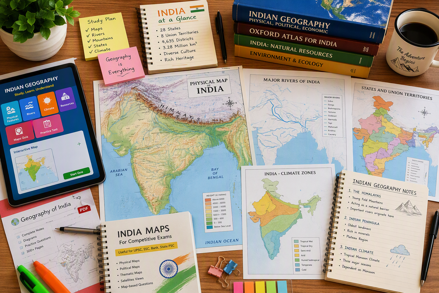
Key Highlights
- This guide explains why important maps are key for UPSC examinations, both in prelims and mains.
- You will get to know the core Indian states, physical geography, major mountain ranges, and river systems that you should mark first.
- It also tells you how to link current affairs with mapping topics to help you remember better.
- The article makes it easy to read and revise by splitting natural vegetation, borders, capitals, and thematic maps into simple parts.
- You will also see what to put in a PDF guide or booklet to get practice quickly.
Table of Contents
Introduction
For many UPSC aspirants, Indian geography feels easier when you see it on a map instead of reading lots of text. A helpful mapping guide matters a lot. It helps you connect physical geography with Indian states, rivers, mountain ranges, and current affairs. When you start finding these features again and again, you remember facts for a longer time. This guide gives a clear way to know what to study, what to mark, and also how to go over it again in a PDF.
Importance of Indian Geography Mapping for UPSC Preparation
Indian geography is not just something to read for UPSC examinations. It is a subject you need to see and understand. Mapping notes help you put rivers, passes, borders, forests, and climatic zones together in one place. This makes it simple to revise them before the exam.
It is very important to know that many questions now link old topics with current affairs. For this reason, the new mapping PDF downloads for 2026 prep should include many things. You should look for details about the extent, states, neighbouring countries, river systems, plants, protected areas, and those special places shown on maps. The next sections will show you what to do and the best way to get ready, step by step.
Role of Maps in UPSC Prelims and Mains
In upsc examinations, maps help you to see big areas of geography as simple shapes, places, and patterns. In prelims, you often get questions where you need to know rivers, mountain passes, states, neighbouring countries, or wetlands. Important maps can help you score well if you know your basics.
For the mains exam, maps can help a lot. A clear sketch of India or the world makes your answers easier to understand. This is true for topics like geography, the environment, disaster management, or world affairs. If you use a simple map with the Himalayas, the Western Ghats, or the South China Sea, it can make your answer stronger and clear.
If you need a PDF with key Indian geography maps for UPSC exam prep, it needs to show political maps, physical maps, drainage, vegetation, soil, borders, and protected areas. A good file links these maps with current affairs. This helps you stay focused while you review for the exam.
How Mapping Skills Boost Scoring Potential
Strong mapping skills help upsc aspirants score better. These skills cut down on mix-ups. You do not just remember random facts. You begin to see how things are linked. UPSC aspirants who practice marking spots on blank maps often remember details quicker when they take the exam.
That advantage gets even bigger with current affairs. A place in the news is easier to remember if you know its state and the river that is close. You remember it better when you know if it is on the coast or near a pass. The ecological setting also helps. This way, revision becomes sharper and people feel more active.
- Mapping helps you build a picture in your mind, so you can remember things quickly during prelims.
- It lets you give better and more clear points in your mains answers.
- It makes it easy to connect regular geography with current affairs.
To get a full set of UPSC geography notes in PDF along with mapping practice, search for materials that give topic-by-topic notes. Try to find the ones that offer practice with blank outlines, and include map questions from past years.
UPSC Exam Trends in Geography Mapping Questions
Recent UPSC examinations show that geography mapping is more than just what you read in textbooks. The questions now check if you can apply what you know. A question might ask about a river that passes through a lake. Or it could ask about a country by talking about a region that is in the news. A strait might be asked about because it matters for trade. This means your map practice for upsc examinations must be about more than just labeling. You have to really understand how places are linked.
Another clear trend shows how current affairs are linked. Places that face conflict, wetlands, nature reserves, border areas, and sea routes often get attention. Many people now want geography notes in PDF format. That way, they can be updated and read fast. This helps when they need quick revision.
- Static and current affairs together are the best mix.
- Mapping India and the world is key for the exam.
- Doing PYQs again and again helps you understand how the questions look.
You can get free Indian geography mapping notes for UPSC as PDF files. Some learning websites have these notes. It is good to use those notes that be easy to read and get updated often.
Overview of Indian Geography Mapping Notes in PDF Format
A good PDF guide is not just a mix of maps. It sorts mapping notes by topic, how hard they are, and if they need to be read again. This helps you study in order. You do not have to switch between chapters that are not related.
Downloadable PDFs are best when they mix maps with news and current affairs. It helps to have topics like size, land shape, rivers, plants, borders, and places kept safe. The next three parts will show what to look for in new resources, topic files, and booklets for revision.
Latest Curated PDF Resources for 2026 UPSC
For 2026 UPSC preparation, you need PDF resources that cover the main topics and recent news. The main topics include things like Indian states and neighbouring countries. You also find mountains, river systems, islands and the area of India in them. To add more value, you must include current affairs. Recent news about places, new facts about coastlines, and places linked to the environment should be there. This makes your study for UPSC even better and more complete.
You should look to see if the material is set up for revision. A big PDF may give you a lot of facts, but it can be hard to use. It is often better to have short files in sections. These are easier for you to download again and practice.
- Pick PDFs that break topics into parts. The PDFs should also have blank maps for practice.
- Use resources that match new current affairs topics.
- Keep a main file for everything. Have a few smaller booklets too. These will help when you revise.
Yes, you can find new study materials on Indian geography. These materials be good for 2026. The PDFs can be downloaded. These are on learning sites that share current affairs, geography topics, and practice for map questions.
Topic-Wise Mapping Notes and Booklets in PDF
Topic-wise mapping notes let you work on one topic at a time. This helps when you need to review rivers a today, mountain passes a tomorrow, and national parks later. If the notes are not sorted, you may waste time looking for the stuff you need.
A useful PDF set about Indian geography should cover all the main topics. It should talk about the extent of India and include important latitudes and longitudes. It needs to cover the main physiographic divisions. It should list states, union territories, and neighbouring countries. The set should give information on river systems, mountain ranges, and passes. There should be details about vegetation and soils too. It must mention all the biosphere reserves, tiger reserves, Ramsar sites, and UNESCO World Heritage Sites. This way, you will have a good guide for all important points, like heritage sites and reserves, in Indian geography.
If you want to make a list of key mapping topics with their PDFs, break them up into different sets. Make one for political maps, one for physical geography, one for environment maps, and one for thematic maps. This setup makes it easy to go over the maps. It also connects well with current affairs.
Downloadable Comprehensive Map Booklets for Revision
Revision gets easier when you put your study notes in map booklets. You do not need to read all long details every time. You can use short notes, marked places, and quick one-line aids to revise. This helps a lot in the last phase before prelims.
A good revision PDF needs to have blank maps and maps with labels. It should also give you short prompts. For example, there can be one page where you are asked to mark the Tropic of Cancer, the standard meridian, the Godavari River, Shipki La, and the Andaman & Nicobar Islands. Another page may mix current affairs with protected places.
Yes, a downloadable Indian geography map booklet for UPSC prelims revision is a good tool for you. The best type is small and easy to use. It covers topics and lets you mark or write notes many times. You do not just read it. You can use it again and again for practice.
Fundamental Physical Maps of India
Physical geography is the backbone of mapping in India. If you know the main shape of the land, later topics feel easier. The relief parts, major rivers, plateaus, coasts, and mountains all link to climate, plants, and places where people live.
Any group of important maps should start with this one. A good PDF for UPSC exam study needs to show the extent of India. It must include the important latitudes, longitudes of India, main land areas, and outlines of states and union territories. Let us look at the most basic layers for a physical map.
Extent and Important Latitudes & Longitudes
Start with the size and shape of India. It will help you make, or read, any other map. Once you know where the mainland and islands are, you will find it simple to put rivers, mountains, and coasts in the right place. UPSC looks for clear knowledge of these main lines.
Two important lines on the map are the tropic of cancer and the standard meridian. The tropic of cancer goes across India. It helps us understand the climate and where things are in the country. The standard meridian is at 82°30′ E. This line is used to set Indian Standard Time.
| Feature | Why it matters in mapping |
|---|---|
| Extent of India | Gives the national frame for all physical and political marking |
| Important latitudes | Helps place climatic and positional references |
| Longitudes of India | Useful for time and spatial understanding |
| Standard meridian | Key line for Indian Standard Time |
| Tropic of Cancer | Important for location-based UPSC questions |
These are the main Indian geography maps that you often see in UPSC exams. Make sure to have them in any good PDF guide.
Relief Features and Physiographic Divisions
India’s land shapes a lot of its geography. If you spot the Himalayas, the Indo-Gangetic-Brahmaputra Plain, the Peninsular Plateau, the coastal plains, and the islands, then you know the basics of physical geography here.
Next, pay attention to the major mountain ranges and linked land areas. The collected material shows the Shiwaliks, Middle Himalayas, Greater Himalayas, Trans-Himalayas, Purvanchal, Aravalis, Vindhyas, Satpuras, Western Ghats, and Eastern Ghats. These are important map topics because they be linked with rivers, climate, passes, and plant and animal life.
A PDF with key Indian geography maps for UPSC exam help should have clear labels. It must also leave some space so you can add new notes when you revise. Once you know these main map parts well, it will be easy to remember other mapping topics later.
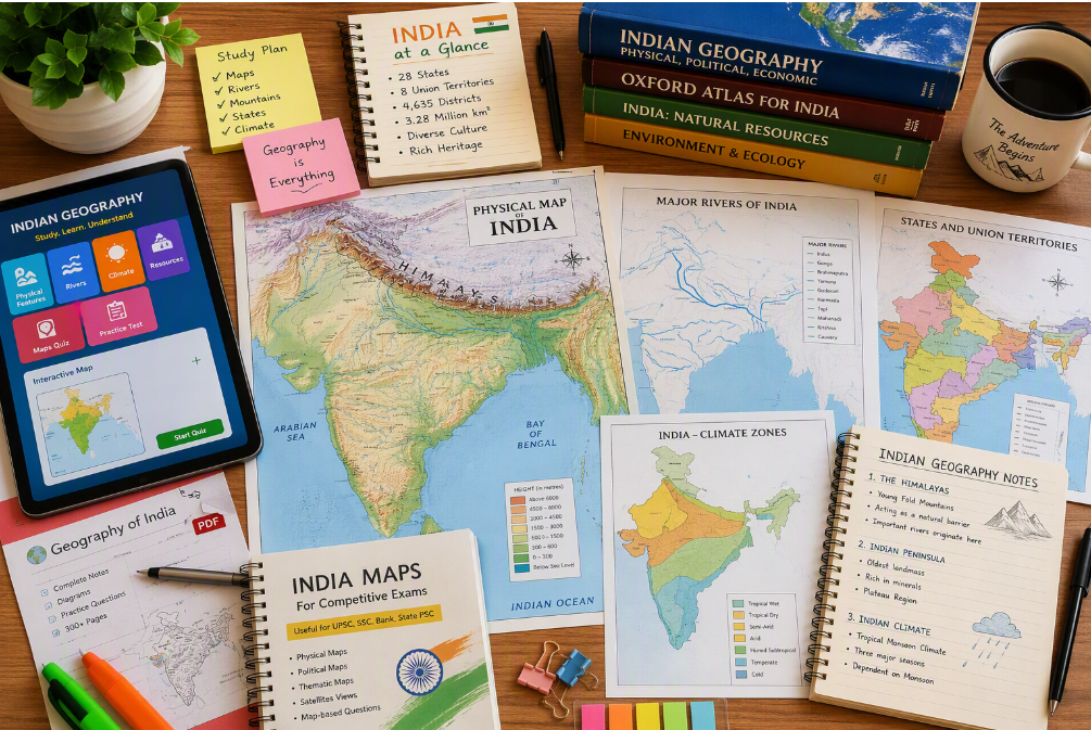
States and Union Territories Map Outline
After you learn about physical features, look at the map outline of the indian states and union territories. This is very important. Many UPSC questions ask you about the location of a place in relation to rivers, borders, coasts, or protected areas. If you do not know which state it is in, your geography might feel weak, even if you know other things well.
Administrative boundaries must be learned with shapes, neighbours, and big regions. You do not need to be perfect at drawing. What matters is to have a clear map in your mind. When you have that, you can add capitals, parks, wetlands, and industries more accurately.
- First, try to spot the border states.
- Once the state outline is fixed, add the union territories.
- Mark the state place on a blank map to help you learn.
Yes, a good PDF with Indian geography maps needs to show the outlines of every state and union territory. These outlines help with most map topics and are useful for anyone studying them.
Political Maps Covering Indian Geography
Political maps help you see the layout of Indian states and their capitals. They show the lines that mark each state. You can also see the countries that touch India by land or sea. These maps are good for UPSC questions. The maps are also great for current affairs. They tell you about borders and key places.
In practice, political maps are tied to geography. They are helpful for the environment, the economy, and relations between countries too. The next subsections will talk about neighbouring countries, capitals, and regional boundaries. These topics come up a lot in revision booklets and exam questions.
Neighbouring Countries and Border Lengths
India’s neighbouring countries are important to know on the map. This material and the UPSC list keep talking about Pakistan, China, Nepal, Bhutan, Myanmar, Bangladesh, and Afghanistan. You need to remember the names of these neighbouring countries. It is also good to know how they connect with Indian border states.
When you connect land border awareness with current affairs, it helps a lot. It is easier for people to follow news about border issues, important passes, and areas close to the border. A clear political map in your head makes all this simple. This is why many mapping PDFs start with this section near the beginning.
| Neighbouring country | Mapping focus |
|---|---|
| Pakistan | Western land border and strategic relevance |
| China | Northern frontier and Himalayan context |
| Nepal | Central Himalayan border link |
| Bhutan | Eastern Himalayan location |
| Myanmar | Northeast connection |
| Bangladesh | Eastern border and enclaved geography awareness |
| Afghanistan | Limited strategic land border reference |
For topic-wise Indian geography PDFs, this part should be in the political map booklet.
Major Cities and Capitals of India
Major cities and capitals may look easy. Still, it is important to practice them on the map. Capitals help you learn Indian states. Major cities show the links for transport, ports, industries, and current affairs.
A good way to practice them is by using borders between places. If you name a state first and then its capital, you will remember it better. This can also help with questions about where a place is in the region, if it is near the sea, if it is a city near a river, or if it has some key role in that area. For example, you will get to know the capitals in the Northeast faster if you keep marking them many times on a blank map.
A PDF that has key Indian geography maps for UPSC exam prep should show state capitals and some big cities. These need to be shown with their physical and political setting. This way is better than just trying to remember a list of names.
Administrative Boundaries and Regions
Administrative boundaries let you split India into different parts that are easy to understand. If you do this, the geography of each state looks less busy. You find it is easier to place mountain ranges in the north, plateaus in the south and center, and long coastlines in both the west and east.
Regions also help you revise faster. You can put indian states and union territories into groups like north, south, east, west, central, and northeast. This way makes it easy when you go over things like agriculture, rivers, forests, or protected places. Using a regional method helps you not mix up nearby states that have places which sound the same.
Yes, an Indian geography map booklet that you can download for UPSC prelims should have both state borders and regional divisions. This will help you practice more often. It also gives you a clear way to remember the map better every time you look at it.
Major Natural Features and Mapping Topics
Once you know the base maps well, move to the main natural things in the area. These are asked a lot because they link to physical geography, the environment, and even news about current affairs or disasters. Learn mountain ranges, rivers, lakes, reservoirs, and passes together as one group.
For topic-wise PDF planning, you can use this part as your booklet for natural features. Add things like mountain systems, river systems, the key lakes, reservoirs, and important passes. The next parts show you how to set this up in a simple way.
Mountain Ranges and Peaks
Mountain ranges play a big part in Indian geography. The material here talks about the Himalayas and their parts. It also covers the Aravalis, Vindhyas, Satpuras, Western Ghats, and Eastern Ghats. Make sure you put these mountain ranges in the right place on your map outline.
Mountain peaks are important because they help you understand where you are in larger land areas. A lot of UPSC study materials talk about peaks like Nanda Devi, Kanchenjunga, and Namcha Barwa. Even if a question is not about these peaks, they make it easier for you to remember how the Himalayas are laid out.
A PDF with key Indian geography maps for UPSC exam prep should show ranges and peaks together. This way, you do not just see the shape of the mountains. You also can remember the main points inside them. This helps you get ready for the exam in a better way.
Rivers, Lakes, and Reservoirs
River systems are a big part of Indian geography mapping. The information given puts each river group in its own section. It splits the Indus system, the Ganga-Brahmaputra system, east-flowing peninsular rivers, and west-flowing peninsular rivers from each other. This way of grouping helps you remember them all much better.
Major rivers like the Ganga, Brahmaputra, Indus, Godavari River, Krishna, Mahanadi, Cauvery, Narmada, and Tapti need to be marked on the map. You should know their starting point, which way they flow, and where they end. There are also many lakes and reservoirs; you need to know these too. UPSC often asks about where the major rivers are and how they are linked with lakes, so practice reading and marking them on the map often.
A good PDF needs to have river systems that are marked with labels. It should also have blank maps so you can quiz yourself. This helps you practice and see what you know. It is useful to link some lakes and reservoirs with current affairs. This makes it feel more like the actual exam and helps you remember things much better.
Important Mountain Passes
Mountain passes may look small on the map, but for UPSC, they hold a lot of importance. They check how exact you can be. A pass is more than a simple name. It is a place in a large mountain area. A pass often links to routes, borders, or important situations. That is why you need to read passes along with physiographic divisions.
Shipki La is a great example because it helps you link a mountain pass with the Himalayas and border areas on a map. This idea also works for passes like Rohtang, Nathu La, and Zoji La, which you find on map lists for the UPSC exam. These are not just facts. They are special points you use to know places.
Shipki La is one of those markers people study to prepare better for geography questions.
- Mark each pass on a blank Himalayan outline.
- Change the passes by adding the names of nearby states or countries at the border.
- Put the passes into groups. Use western, central, and eastern parts for this.
In topic-wise PDFs, the important mountain passes should be in the natural features booklet. This will make it easy for you to read and remember later.
Valuable Thematic Maps for UPSC
Thematic maps help you a lot in your preparation. They do more than just show the physical and political features. You get to see details like nuclear power plants, nuclear power, ports, science centers, where resources are found, or why a place is good for transport. UPSC gives marks for this extra work, especially when you link what you know with how you use it.
In a topic-wise PDF system, thematic maps need to be made as their own booklet. This booklet can include nuclear power plants, ISRO centers, ports, maritime infrastructure, and some other key places. These topics help you link geography with science, the economy, and current affairs. They are also good for understanding things about nuclear power and other big subjects of today.
Nuclear Power Plants Locations
Nuclear power should be in thematic maps because it depends on where it is found. It is also part of science, the economy, and energy. The material here shows information about nuclear fission, how reactors work, India’s three-stage nuclear power plan, and where uranium and thorium can be found. This shows that learning based on place can help a lot, even if the question is just about ideas.
A map of nuclear power plants helps you see where these plants are near coasts, rivers, and where they are found in each area. This is important because maps like this train you to think about how things are spread out, not just in geography, but in other areas too. UPSC often wants you to make these kinds of connections that go across topics, not just with nuclear power or nuclear power plants.
| Thematic area | What to mark in your map notes |
|---|---|
| Nuclear power | Plant locations and regional spread |
| Nuclear power plants | Site-based revision and repeated blank map practice |
| Fuel context | Uranium and thorium distribution in broad terms |
| Program link | India’s three-stage nuclear power understanding |
A PDF with key Indian geography maps should have a page about nuclear power in the part where they cover different topics.
ISRO Centres and Science Hubs
ISRO centers and science hubs are smart to add on thematic maps. At first, they might feel like they do not fit with regular geography. Still, they are good for anyone who is doing location-based prep. UPSC many times brings together science and geography by talking about sites, things built there, and why these are key for the country.
When you mark ISRO-related places, you make your map practice better and more useful. It helps you give good answers about space technology, research systems, and development in different areas. A thematic map here does not need too many details. Just knowing the main places can help you when you read again.
Yes, you can get free Indian geography mapping notes for UPSC as PDF downloads on some websites. The good ones have more than just maps. They also give extra parts about ISRO, science places, and big Infrastructure points. This helps with all-round preparation.
Ports and Maritime Infrastructure
Ports are a good topic when you read about maps. They link the land with trade, security, and are often in the news. To understand them well, work on each coast by itself. First, read about the ports on the Arabian Sea side. Next, read about ports on the Bay of Bengal side. After this, you can put them together for a full national view of ports and see how they all fit in with current affairs.
When you look at maritime infrastructure on a map of the Indian Ocean, things start to make more sense. This shows why coastlines, islands, and sea routes are important. It also helps you talk about the Red Sea, the Persian Gulf, the Strait of Hormuz, and trade with other countries. These places are key when people want to prepare for things that may happen in the future.
A PDF with key Indian geography maps for UPSC prep should show all major ports. It should also have maritime infrastructure on a clear coastline map. This helps you join static geography and current affairs.
Environmental and Ecological Maps
Environmental maps are very important for UPSC now. They bring together geography, ecology, and current affairs at one spot. Things like natural vegetation, Ramsar sites, biosphere reserves, national parks, and buffer zones are often asked in location-based questions or in answer writing.
These maps also help you understand how things change by region. You can see how forests change with rainfall. It also shows how wetlands connect to rivers. Protected areas also fit into larger places where many plants and animals live. The next parts talk about plants, protected areas, and maps about places with natural or cultural value.
Vegetation Zones and Forest Areas
Vegetation zones are best learned as patterns. Do not see them as just names. The collected details show the types of natural vegetation in India: moist tropical forests, dry tropical forests, montane sub-tropical forests, montane temperate forests, and alpine forests. This way, you get a good plan for map study.
Tropical evergreen is one of the most important types to know. You can find it often in your basic geography revision. It’s good to link forest areas with the climate that is in that place. You should also know where they are on the map. This will help you when you get questions about how natural vegetation, like tropical evergreen, connects with rain or high and low land.
A PDF that has the key Indian geography maps for UPSC exam study should show the vegetation zones on an easy-to-read India outline. This way, you can see right away where the tropical evergreen areas, montane regions, and dry forest zones are in India. This is more helpful than reading long text because it is simple to get the main points at one look.
Biosphere Reserves and National Parks
Protected area mapping is a good way to connect the environment to location memory. Biosphere reserves, national parks, tiger reserves, and wildlife sanctuaries are all important for us. You do not need to remember them as one long list. Put them into groups by region. With this, you can go back, mark them again and again, and learn them better.
This way of doing things is helpful because it breaks big tasks into smaller parts. For example, if you need to mark a biosphere reserve, also write down if the place is in a forest, has hills, is near the coast, or by a river. This gives you more to say about the place. It also helps you remember it better, not just for geography but for current affairs too.
For topic-wise PDFs, it is good to include protected areas in an environment map booklet. This booklet can have tiger reserves, major national parks, wildlife sanctuaries, biosphere reserves, and chosen Ramsar sites. That way, you can read and learn all of them as one clear map theme.
UNESCO World Heritage Sites in India
UNESCO World Heritage Sites help us learn about both culture and geography. When you put these heritage sites on a map, it lets people see the region better. It also helps make different areas of study work together well. Some heritage sites are close to places like forests, hills, or other nature spots.
This is why you should add heritage mapping to your set when you read and study about the environment and culture. It lets you remember where things are by giving you the full story, not just plain memory rules. Sometimes, heritage sites can be near big protected places or biosphere reserves. This can help you learn in a more joined-up way.
- Mark heritage sites by the region instead of all together.
- Connect each site location with the nearby state and the main type of land in that area.
- Update them along with the big cultural and nature zones.
A PDF with important Indian geography maps can be very helpful. You can also add a layer to show the UNESCO World Heritage Sites for better recall. This way, you get to see where the heritage sites are in India, which helps you remember them more easily.
Practice & Application: Mapping Exercises in PDF
Reading maps helps, but drawing and marking them really helps you remember things. This is why you should practice mapping often. In upsc examinations, it matters how fast you can point out a place, see a pattern, or find a link between things.
A good revision PDF should have practice questions, blank outlines, and also include short answer prompts. This type of exercise-based file can turn passive study into active learning. The next parts will talk about past year questions, sample practice tasks, and easy tips for using PDFs to help with revision.
Past Year UPSC Geography Map-Based Questions
Past year questions are a good way to see how UPSC examinations use mapping. The collected material shows that you might get questions about rivers going into lakes, countries found by looking at seas, or places in the news linked to the right country. This shows that mapping questions check how you think, not just what you remember.
That is why it is good for your PDF practice set to have both Indian and world examples. A practice file will be more helpful if you add Indian rivers and mountain passes. You should also put in places from around the globe like the North Sea, Red Sea, Mediterranean Sea, Black Sea, Pacific Ocean, Atlantic Ocean, and the South China Sea.
- Solve PYQs after you finish each mapping topic.
- Mark every wrong location again on a blank map.
- Keep a small notebook where you write down mapping mistakes that happen more than one time.
A PDF that has key Indian geography maps is even better if you add questions from past years. It also helps a lot when you get practice questions that focus on answers. This way, the PDF is a good tool for study and practice.
Sample Mapping Exercises Tailored for UPSC
Sample exercises need to follow the UPSC pattern. This means each one should be a short and quick task. For example, one exercise might ask you to mark the Tropic of Cancer, the standard meridian, and the Lakshadweep Islands on a map. Another exercise could ask you to show the Godavari River, the Western Ghats, and a biosphere reserve on one outline.
This way of learning helps because it connects many topics, like the exam does. A river can connect to a lake. A mountain pass can link to a border state. A current affairs spot can connect with a bigger area. Mixing topics together is better than just looking at them one by one.
Key Indian geography maps that often show up in UPSC exams are maps of physical India, political India, neighbouring countries, mountain ranges, river systems, passes, the types of plants, and places that are protected. These are the first maps you should cover in your PDF practice set.
Tips for Effective Map Revision Using PDF Notes
To get ready in the best way, you have to read and practice many times. You cannot do it by reading once. PDF notes are good for this. They are easy to carry, simple to keep together, and you can read them again anytime. But, you still need to have a plan. If you only scroll through maps, you will not remember much. You need to highlight things, draw them again, and ask yourself questions to learn well.
Keep one main booklet for all your mapping notes. Have a smaller revision PDF that you use for quick review. Use the big file when you want to learn. Use the small file every day just to recall things fast. This way, you do not feel overloaded. It also helps you practice with maps often.
- Go over one map theme each day for ten minutes.
- Try empty maps at the end of every read.
- Put places from current affairs on your PDF notes.
Yes, having an Indian geography map booklet that you can download for UPSC prelims revision is very helpful. It lets you mark things as you go and practice again and again. This way, you can get better each time you use it.
Conclusion
To sum up, learning Indian geography mapping is very important if you want to do well in UPSC exams. It helps you know more about physical and political maps and can also increase your marks in both prelims and mains. Using the right PDF resources can help make your study easier. You will be able to understand topics like types of land, borders, and environment maps. When you use these notes in your study plan, you can answer map-type questions better and feel more confident. Download our important mapping resources now to get ready for your exams!
How can I download reliable Indian geography mapping notes PDFs for UPSC?
Get mapping notes in PDF format from good websites that share information in a clear way and bring in current affairs updates. Choose pages that have physical geography, political maps, environment maps, and practice tasks together. It is easier to read and remember when you use small booklets for each topic instead of one big file.
What are the best sources for Indian geography mapping notes – including Sunya IAS or Amit Garg?
The best sources are those you can trust. They show mapping notes in a clear and simple way that helps with revision. It does not matter if you use Sunya IAS, Amit Garg, or something else. You should look for clear details, topic-by-topic notes, practice with blank maps, and updates that include current affairs. Do not pick a source just for the name.
Are updated mapping PDF downloads available for 2026 UPSC exam prep?
Yes, there are updated mapping notes in PDF that can help you with 2026 UPSC prep. These are found on sites that often share geography content and current affairs. Pick files that cover Indian states, neighbouring countries, river systems, mountain passes, protected areas, and practice questions. This makes your revision better.